Fil:1897 administrative map of the Marshall Islands, Pacific Ocean.jpg

Storleik på førehandsvising: 532 × 599 pikslar. Andre oppløysingar: 213 × 240 pikslar | 426 × 480 pikslar | 682 × 768 pikslar | 1 254 × 1 412 pikslar.
Opphavleg fil (1 254 × 1 412 pikslar, filstorleik: 609 KB, MIME-type: image/jpeg)
Følgjande er henta frå filomtalen åt denne fila på Wikimedia Commons:
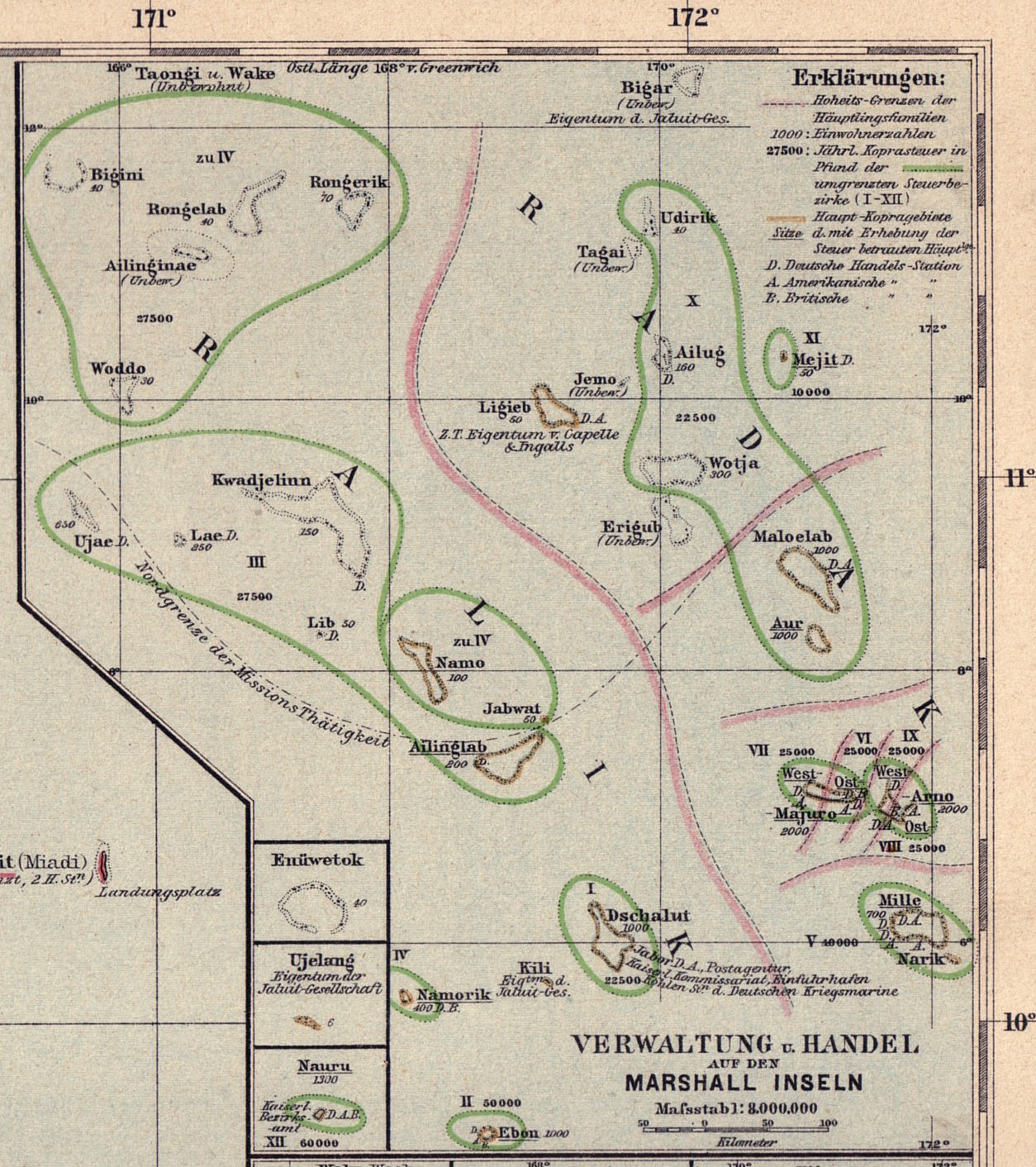
Skildring
| Skildring |
English: Marshall Islands, Pacific Ocean: 1897 administrative map |
| Dato | |
| Kjelde | http://marshall.csu.edu.au/Marshalls/html/histmaps/Langhans1897_map1admin.jpg |
| Opphavsperson | Paul Langhans (* 1. April 1867 in Hamburg; † 17. Januar 1952 in Gotha) |
Lisensiering:
This media file is in the public domain in the United States. This applies to U.S. works where the copyright has expired, often because its first publication occurred prior to January 1, 1929, and if not then due to lack of notice or renewal. See this page for further explanation.
|
 | |
 |
This image might not be in the public domain outside of the United States; this especially applies in the countries and areas that do not apply the rule of the shorter term for US works, such as Canada, Mainland China (not Hong Kong or Macao), Germany, Mexico, and Switzerland. The creator and year of publication are essential information and must be provided. See Wikipedia:Public domain and Wikipedia:Copyrights for more details.
|
Filhistorikk
Klikk på dato/klokkeslett for å sjå fila slik ho var på det tidspunktet.
| Dato/klokkeslett | Miniatyrbilete | Oppløysing | Brukar | Kommentar | |
|---|---|---|---|---|---|
| gjeldande | 22. mai 2011 kl. 19:57 | | 1 254 × 1 412 (609 KB) | Ratzer |
Filbruk
Den følgjande sida bruker denne fila: