Fil:Bering Sea Aleutian Is Alaska map.png
Storleik på førehandsvising: 684 × 599 pikslar. Andre oppløysingar: 274 × 240 pikslar | 548 × 480 pikslar | 876 × 768 pikslar | 1 168 × 1 024 pikslar | 1 457 × 1 277 pikslar.
Opphavleg fil (1 457 × 1 277 pikslar, filstorleik: 2,04 MB, MIME-type: image/png)
Følgjande er henta frå filomtalen åt denne fila på Wikimedia Commons:
Skildring
| Skildring |
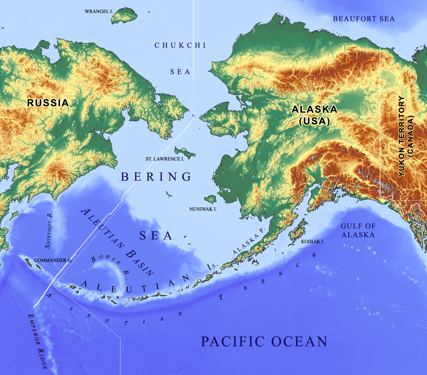
English: Physical geography of Alaska and the Bering Sea with emphasis on oceanographic features of the Bering Sea and the Commander-Aleutian island arc. |
| Dato | |
| Kjelde |
Eige arbeid |
| Opphavsperson | Base map: © OpenStreetMap contributors |
| Andre versjonar |
   |
Lisensiering:
Denne filen er lisensiert under lisensen Creative Commons Navngivelse-DelPåSammeVilkår 2.0 Generisk
- Du står fritt til å:
- til å dela – til å kopiera, distibuera og overføra arbeidet
- til å blanda – til å endra verket
- På desse vilkåra:
- namngjeving – Du lyt godskriva verket på den måten som opphavpersonen eller lisensgjevaren har oppgjeve (men ikkje på ein slik måte at det kan verka som om dei går god for deg eller måten du nyttar verket på).
- del på same vilkåra – Om du remiksar, omarbeider, eller på annan måte byggjer på dette verket, kan du berre distribuera resultatet under den same eller ein samsvarande lisens som denne.
Filhistorikk
Klikk på dato/klokkeslett for å sjå fila slik ho var på det tidspunktet.
| Dato/klokkeslett | Miniatyrbilete | Oppløysing | Brukar | Kommentar | |
|---|---|---|---|---|---|
| gjeldande | 10. februar 2017 kl. 22:20 | | 1 457 × 1 277 (2,04 MB) | Gretarsson | wrong map uploaded |
| 10. februar 2017 kl. 22:15 |  | 1 457 × 1 277 (1,95 MB) | Gretarsson | incorrect hyphens removed | |
| 10. februar 2017 kl. 22:06 |  | 1 457 × 1 277 (2,04 MB) | Gretarsson | {{Information |Description ={{en|1=Physical geography of Alaska and the Bering Sea with emphasis on oceanographic features of the Bering Sea and the Commander-Aleutian arc.}} |Source ={{own}}<br /> Base map is from https://maps-for-free.com... |
Filbruk
Den følgjande sida bruker denne fila:
Global filbruk
Desse andre wikiane nyttar fila:
- Bruk på bg.wikipedia.org
- Bruk på eu.wikipedia.org
- Bruk på sv.wikipedia.org
- Bruk på uk.wikipedia.org