Fil:Chile-Chonos Archipelago.jpg
Opphavleg fil (1 032 × 1 276 pikslar, filstorleik: 572 KB, MIME-type: image/jpeg)
Følgjande er henta frå filomtalen åt denne fila på Wikimedia Commons:
Skildring
| Skildring |
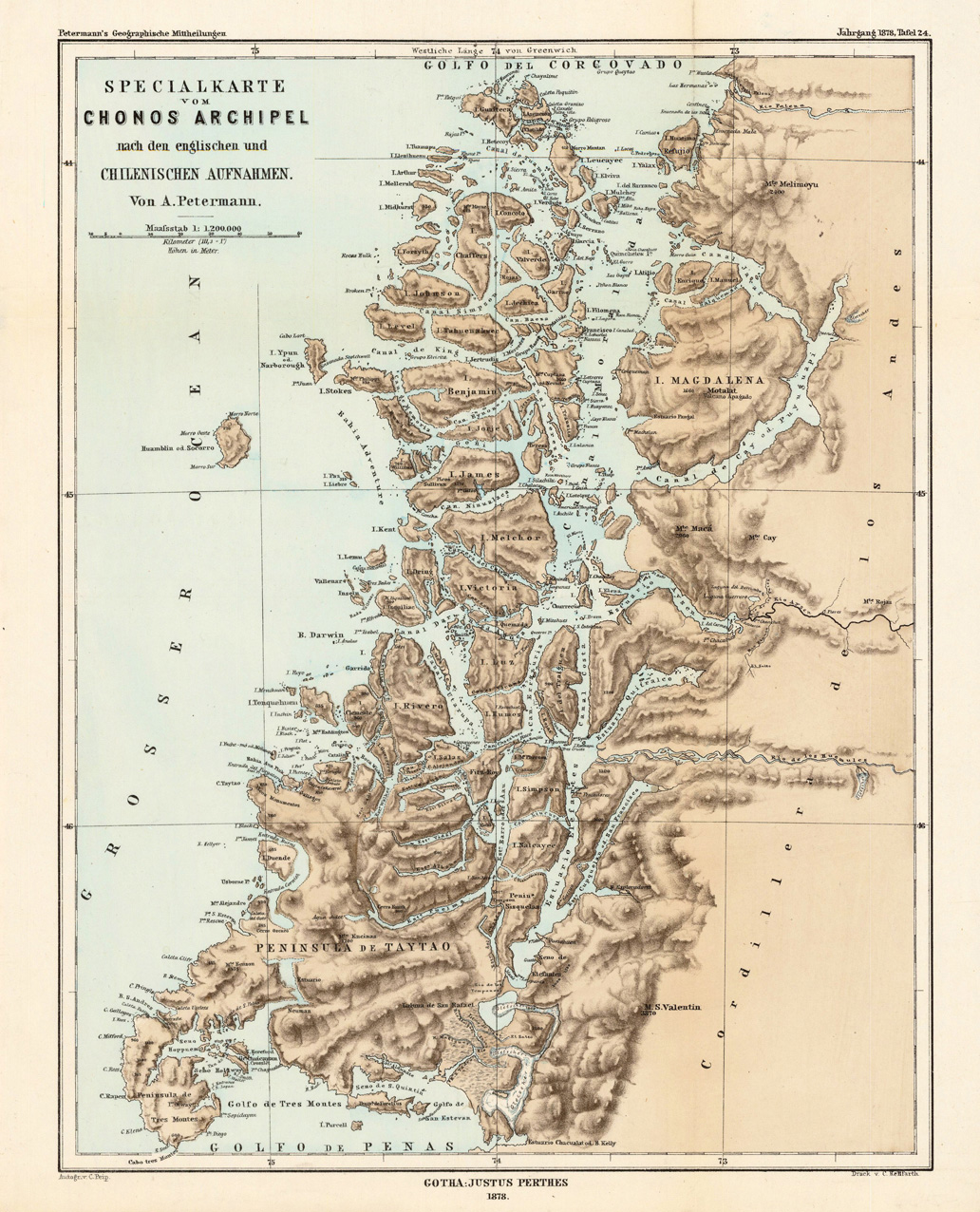
English: Lithograph, printed in colors when published. Detailled map, showing the Chonos Archipel from the gulf of Penas with the Peninsula de Taytao up to the gulf of Corcovado. Very detailled map with an enormous number of islands and peninsulas, most of them with place names. The map provides an overview of the results of the travel by Th. von Heugelin to Somalia. It is also ornated with a scene of birds and mammals, which were discovered by Th. Heugelin in Somalia. |
| Dato | |
| Kjelde | http://www.bergbook.com/htdocs/woda/data/demo/descriptions/17333.htm |
| Opphavsperson | Petermann, A. |
Lisensiering:
|
Dette verket er falt i det fri i Noreg, og dei landa som har opphavsrettsleg vernetid på 70 år etter opphavsmannen sin død, eller kortare.
| |
| Denne fila er fastsett å vera fri for kjende avgrensingar under opphavsrettlovgjeving, medrekna alle relaterte og nærliggjande rettar. | |
Filhistorikk
Klikk på dato/klokkeslett for å sjå fila slik ho var på det tidspunktet.
| Dato/klokkeslett | Miniatyrbilete | Oppløysing | Brukar | Kommentar | |
|---|---|---|---|---|---|
| gjeldande | 24. februar 2010 kl. 04:43 | | 1 032 × 1 276 (572 KB) | Rec79 | {{Information |Description={{en|1=Lithograph, printed in colors when published. Detailled map, showing the Chonos Archipel from the gulf of Penas with the Peninsula de Taytao up to the gulf of Corcovado. Very detailled map with an enormous number of islan |
Filbruk
Den følgjande sida bruker denne fila:
Global filbruk
Desse andre wikiane nyttar fila:
- Bruk på ca.wikipedia.org
- Bruk på de.wikipedia.org
- Bruk på en.wikipedia.org
- Bruk på es.wikipedia.org
- Bruk på fr.wikipedia.org
- Bruk på fr.wiktionary.org
- Bruk på gl.wikipedia.org
- Bruk på it.wikipedia.org
- Bruk på lt.wikipedia.org
- Bruk på lv.wikipedia.org
- Bruk på ru.wikipedia.org
- Bruk på sh.wikipedia.org
- Bruk på www.wikidata.org