Fil:Erzurum districts.png
Storleik på førehandsvising: 776 × 600 pikslar. Andre oppløysingar: 311 × 240 pikslar | 621 × 480 pikslar | 994 × 768 pikslar | 1 056 × 816 pikslar.
Opphavleg fil (1 056 × 816 pikslar, filstorleik: 38 KB, MIME-type: image/png)
Følgjande er henta frå filomtalen åt denne fila på Wikimedia Commons:
Skildring
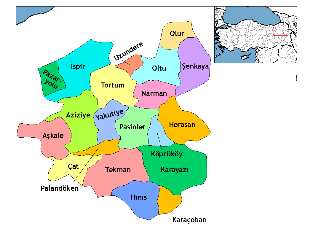
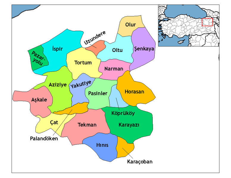
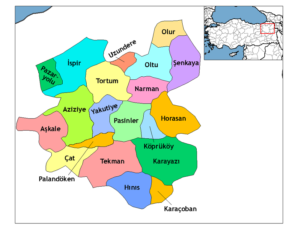
| Skildring | Map of the districts of Erzurum province in Turkey. Created by Rarelibra 19:53, 1 December 2006 (UTC) for public domain use, using MapInfo Professional v8.5 and various mapping resources. Edited by One Homo Sapiens Corrected text where İ,Ş,ı,ğ,or ş occurs in name. Source: [statoids-com]. Increased font size and enhanced color differences among adjacent districts. |
| Dato | 1. desember 2006 (original upload date) |
| Kjelde | Inga maskinlesbar kjelde er oppgjeven. Frå påstandar om opphavsrett vert det rekna med at det er eige arbeid. |
| Opphavsperson | Ingen maskinlesbar opphavsperson er oppgjeven. Frå påstandar om opphavsrett vert det rekna med at Rarelibra er opphavsperson. |
Lisensiering:
| Eg, opphavsrettshaldaren til dette verket, frigjev dette verket til ålmenta. Dette gjeld over heile verda. I somme landa er dette kan henda ikkje rettsleg mogeleg. I det fall: Eg gjev kven som helst rettane til å nytta dette verket for kva som helst føremål og utan vilkår, minder vilkår er kravde etter lova. |
Filhistorikk
Klikk på dato/klokkeslett for å sjå fila slik ho var på det tidspunktet.
| Dato/klokkeslett | Miniatyrbilete | Oppløysing | Brukar | Kommentar | |
|---|---|---|---|---|---|
| gjeldande | 18. april 2009 kl. 04:52 | | 1 056 × 816 (38 KB) | One Homo Sapiens | Added Aziziye, Palandöken and Yakutiye, that replaced Erzurum merkezi and Ilıca districts. Source: << www.erzurum.gov.tr >> |
| 29. desember 2008 kl. 00:20 |  | 1 056 × 816 (41 KB) | One Homo Sapiens | Corrected text where İ,Ş,ı,ğ,or ş occurs in name. Source: [statoids-com]. Increased font size and enhanced color differences among adjacent districts. | |
| 1. desember 2006 kl. 21:53 |  | 1 056 × 816 (35 KB) | Rarelibra | Map of the districts of Erzurum province in Turkey. Created by ~~~~ for public domain use, using MapInfo Professional v8.5 and various mapping resources. |
Filbruk
Den følgjande sida bruker denne fila:
Global filbruk
Desse andre wikiane nyttar fila:
- Bruk på ar.wikipedia.org
- Bruk på arz.wikipedia.org
- Bruk på ast.wikipedia.org
- Bruk på azb.wikipedia.org
- Bruk på ba.wikipedia.org
- Bruk på bs.wikipedia.org
- Bruk på ca.wikipedia.org
- Bruk på cs.wikipedia.org
- Bruk på de.wikipedia.org
- Bruk på diq.wikipedia.org
- Bruk på en.wikipedia.org
Sjå meir global bruk av denne fila.