Fil:IsraelCVFRtopography.jpg
Storleik på førehandsvising: 446 × 599 pikslar. Andre oppløysingar: 179 × 240 pikslar | 357 × 480 pikslar | 572 × 768 pikslar | 1 233 × 1 656 pikslar.
Opphavleg fil (1 233 × 1 656 pikslar, filstorleik: 191 KB, MIME-type: image/jpeg)
Følgjande er henta frå filomtalen åt denne fila på Wikimedia Commons:
| Skildring | |||
| Dato | |||
| Kjelde | Aeronautical Information Publication - Domestic (AIP) of the Israel Civil Aviation Administration – presently Civil Aviation Authority (CAA) | ||
| Opphavsperson | Etan Tal | ||
| Løyve (Gjenbruk av denne fila) |
|
Filhistorikk
Klikk på dato/klokkeslett for å sjå fila slik ho var på det tidspunktet.
| Dato/klokkeslett | Miniatyrbilete | Oppløysing | Brukar | Kommentar | |
|---|---|---|---|---|---|
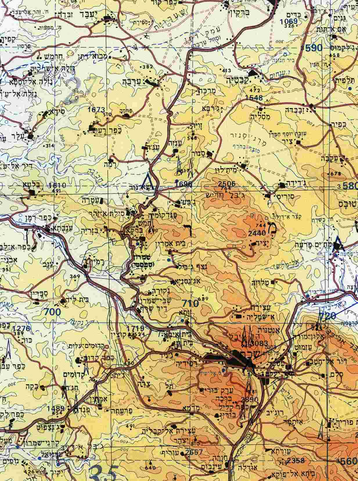
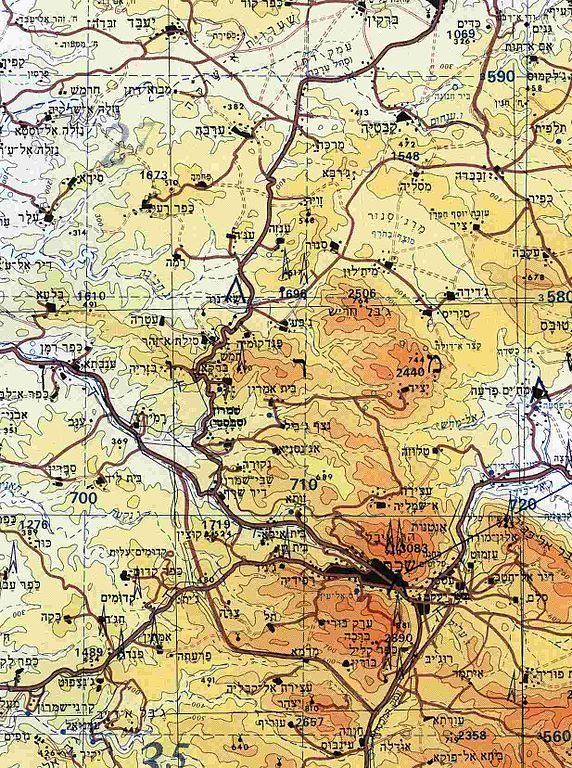
| gjeldande | 8. oktober 2009 kl. 14:29 | | 1 233 × 1 656 (191 KB) | Etan J. Tal | {{Information |Description={{en|1=Section of topographical map of Nablus area (West Bank)}} |Source=Aeronautical Information Publication - Domestic (AIP) of the Israel Civil Aviation Administration – presently Civil Aviation Authority (CAA) |Aut |
Filbruk
Den følgjande sida bruker denne fila:
Global filbruk
Desse andre wikiane nyttar fila:
- Bruk på ar.wikipedia.org
- Bruk på arz.wikipedia.org
- Bruk på ast.wikipedia.org
- Bruk på bn.wikipedia.org
- Bruk på ca.wikipedia.org
- Bruk på ceb.wikipedia.org
- Bruk på diq.wikipedia.org
- Bruk på el.wikipedia.org
- Bruk på en.wikipedia.org
- Bruk på eo.wikipedia.org
- Bruk på es.wikipedia.org
- Bruk på eu.wikipedia.org
- Bruk på gl.wikipedia.org
- Bruk på he.wikipedia.org
- Bruk på hu.wikipedia.org
- Bruk på ko.wikipedia.org
- Bruk på ml.wikipedia.org
- Bruk på nl.wikipedia.org
- Bruk på pt.wikipedia.org
- Bruk på ro.wikipedia.org
- Bruk på uk.wikipedia.org
- Bruk på vi.wikipedia.org
- Bruk på www.wikidata.org