Fil:Kurarivermap.jpg
Storleik på førehandsvising: 800 × 467 pikslar. Andre oppløysingar: 320 × 187 pikslar | 640 × 373 pikslar | 1 024 × 598 pikslar | 1 484 × 866 pikslar.
Opphavleg fil (1 484 × 866 pikslar, filstorleik: 1,57 MB, MIME-type: image/jpeg)
Følgjande er henta frå filomtalen åt denne fila på Wikimedia Commons:
Skildring
| Skildring |
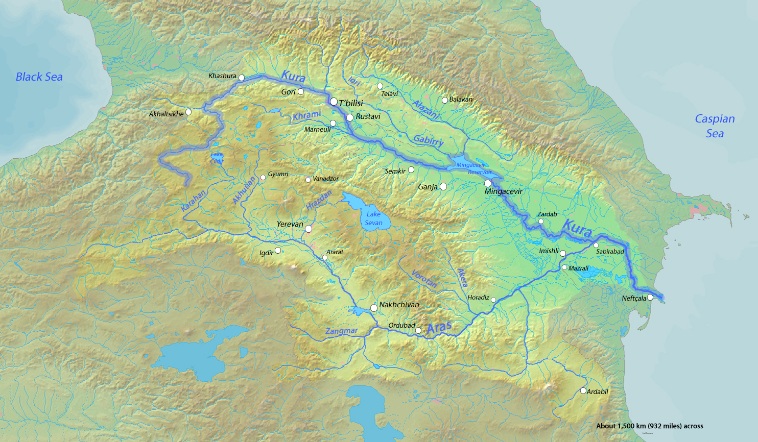
English: Map of the Kura River, whose watershed drains much of the Caucasus region in Azerbaijan, Georgia, Armenia, Turkey and Iran into the Caspian Sea |
| Dato | |
| Kjelde | Background and river course data from http://www2.demis.nl/mapserver/mapper.asp |
| Opphavsperson | Shannon |
Lisensiering:
Eg, opphavsrettshaldaren til verket, publiserer det hermed under desse lisensane:

|
Det er tillate å kopiera, distribuera og/eller modifisera dette dokumentet under retningslinene som er skildra i GNU fri dokumentasjonslisens, versjon 1.2 eller seinare utgåve utgjeven av Free Software Foundation; med alle seksjonane, utan nokon framsidetekstar og baksidetekstar. Ein kopi av lisensen er inkludert i avsnittet GNU Free Documentation License. |
This file is licensed under the Creative Commons Attribution-Share Alike 4.0 International, 3.0 Unported, 2.5 Generic, 2.0 Generic and 1.0 Generic license.
- Du står fritt til å:
- til å dela – til å kopiera, distibuera og overføra arbeidet
- til å blanda – til å endra verket
- På desse vilkåra:
- namngjeving – Du lyt godskriva verket på den måten som opphavpersonen eller lisensgjevaren har oppgjeve (men ikkje på ein slik måte at det kan verka som om dei går god for deg eller måten du nyttar verket på).
- del på same vilkåra – Om du remiksar, omarbeider, eller på annan måte byggjer på dette verket, kan du berre distribuera resultatet under den same eller ein samsvarande lisens som denne.
Du kan velje den lisensen du sjølv tykkjer er best.
Filhistorikk
Klikk på dato/klokkeslett for å sjå fila slik ho var på det tidspunktet.
| Dato/klokkeslett | Miniatyrbilete | Oppløysing | Brukar | Kommentar | |
|---|---|---|---|---|---|
| gjeldande | 18. oktober 2013 kl. 03:16 | | 1 484 × 866 (1,57 MB) | Shannon1 | fixed location of Hrazdan River |
| 12. mars 2010 kl. 04:47 |  | 1 484 × 866 (783 KB) | Shannon1 | {{Information |Description={{en|1=Map of the Kura River, whose watershed drains much of the Caucasus region in Azerbaijan, Georgia, Armenia, Turkey and Iran into the Caspian Sea}} |Source=Background and river course data from http://www2.demis.nl/mapserve |
Filbruk
Den følgjande sida bruker denne fila:
Global filbruk
Desse andre wikiane nyttar fila:
- Bruk på af.wikipedia.org
- Bruk på ar.wikipedia.org
- Bruk på av.wikipedia.org
- Bruk på az.wikipedia.org
- Bruk på az.wiktionary.org
- Bruk på be.wikipedia.org
- Bruk på bg.wikipedia.org
- Bruk på ca.wikipedia.org
- Bruk på ceb.wikipedia.org
- Bruk på cs.wikipedia.org
- Bruk på da.wikipedia.org
- Bruk på de.wikipedia.org
- Bruk på en.wikipedia.org
- Bruk på eo.wikipedia.org
- Bruk på es.wikipedia.org
- Bruk på et.wikipedia.org
- Bruk på eu.wikipedia.org
- Bruk på frr.wikipedia.org
- Bruk på fr.wikipedia.org
Sjå meir global bruk av denne fila.