Fil:Mali adm location map.svg

Opphavleg fil (SVG-fil, standardoppløysing: 1 644 × 1 568 pikslar, filstorleik: 301 KB)
Følgjande er henta frå filomtalen åt denne fila på Wikimedia Commons:
Skildring
| Skildring |
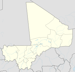
Deutsch: Positionskarte von Mali
English: Location map of Mali
|
||||||||||||
| Dato | |||||||||||||
| Kjelde |
Own work using:
|
||||||||||||
| Opphavsperson | NordNordWest | ||||||||||||
| Andre versjonar |
|
||||||||||||
_location_map.svg)

|
This map has been made or improved in the German Kartenwerkstatt (Map Lab). You can propose maps to improve as well.
|
Lisensiering:
Usage of this file with:

explanatory notes: Legally binding is only the full legalcode. For a free usage I recommend to respect the following licence conditions:
1. Provide my name as given above: NordNordWest,
2. a copy of, or the URI for, the applicable license: https://creativecommons.org/licenses/by-sa/3.0/de/legalcode,
3. the title of the work,
4. in the case of an adaptation, a credit identifying the use of the work in the adaptation.
This license and the rights granted hereunder will terminate automatically upon any breach by you of the terms of this license. Any of the above conditions can be waived if you get permission from the copyright holder. If you have questions or wish differing conditions, please contact me through nnwest or my discussion page ![]() t-online.de
t-online.de
- Du står fritt til å:
- til å dela – til å kopiera, distibuera og overføra arbeidet
- til å blanda – til å endra verket
- På desse vilkåra:
- namngjeving – Du lyt godskriva verket på den måten som opphavpersonen eller lisensgjevaren har oppgjeve (men ikkje på ein slik måte at det kan verka som om dei går god for deg eller måten du nyttar verket på).
- del på same vilkåra – Om du remiksar, omarbeider, eller på annan måte byggjer på dette verket, kan du berre distribuera resultatet under den same eller ein samsvarande lisens som denne.

Filhistorikk
Klikk på dato/klokkeslett for å sjå fila slik ho var på det tidspunktet.
| Dato/klokkeslett | Miniatyrbilete | Oppløysing | Brukar | Kommentar | |
|---|---|---|---|---|---|
| gjeldande | 18. mai 2019 kl. 22:25 | | 1 644 × 1 568 (301 KB) | NordNordWest | upd |
| 30. november 2014 kl. 15:43 |  | 1 644 × 1 568 (297 KB) | NordNordWest | == {{int:filedesc}} == {{Information |Description= {{de|1=Positionskarte von Mali}} {{en|1=Location map of Mali}} {{Location map series N |stretching=105 |top=25.5 |bottom=9.7 |left=-12.6 |right=4.8 }} |Source={{Own using}} * United States National Ima... |
Filbruk
Global filbruk
Desse andre wikiane nyttar fila:
- Bruk på af.wikipedia.org
- Bruk på am.wikipedia.org
- Bruk på an.wikipedia.org
- Bruk på ar.wikipedia.org
- Bruk på arz.wikipedia.org
- Bruk på ast.wikipedia.org
- Bruk på azb.wikipedia.org
- Bruk på az.wikipedia.org
- Bruk på ba.wikipedia.org
- Bruk på be-tarask.wikipedia.org
- Bruk på be.wikipedia.org
Sjå meir global bruk av denne fila.