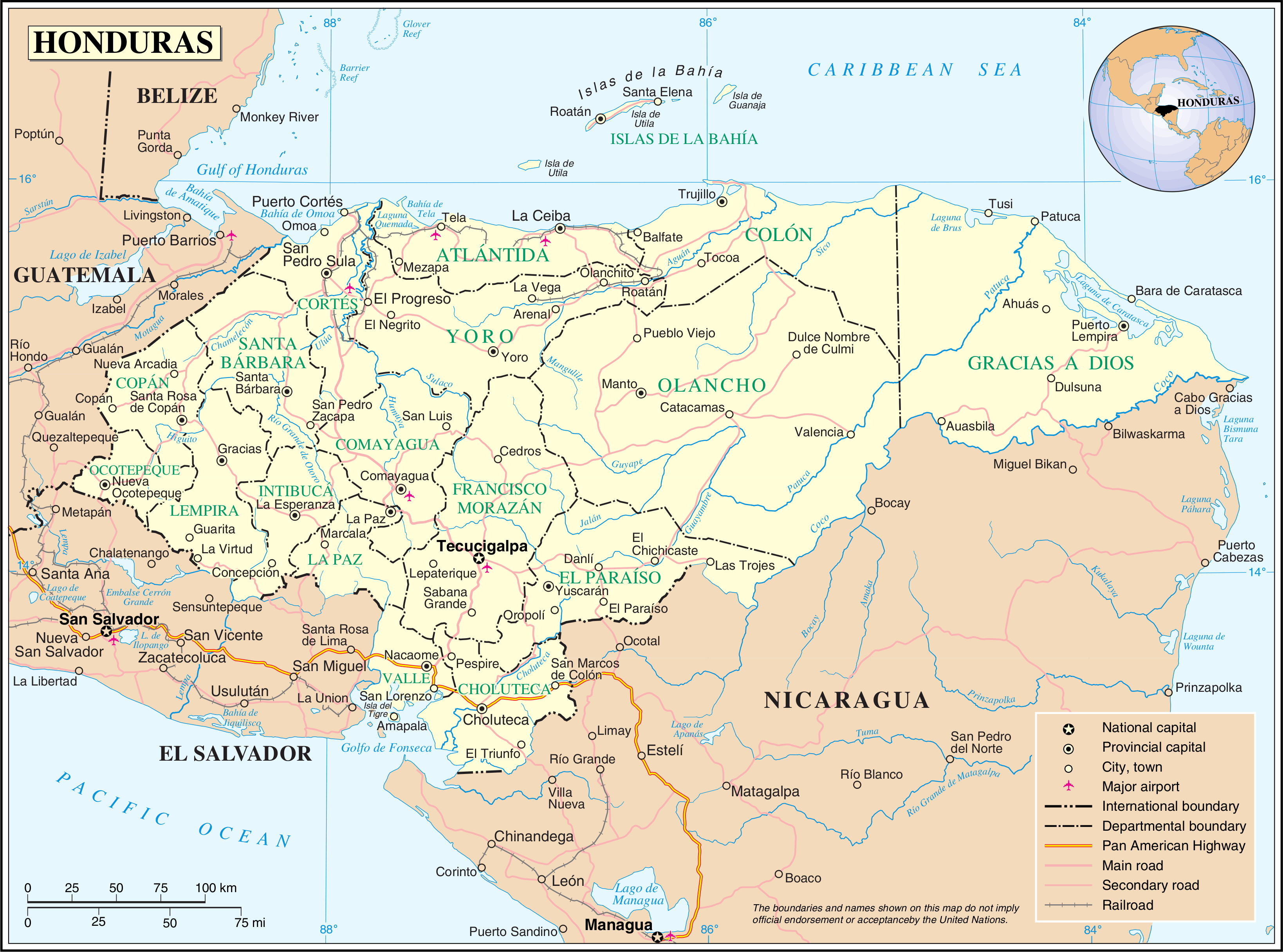
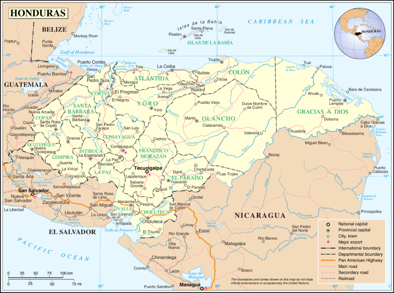
Fil:Un-honduras.png
Opphavleg fil (3 277 × 2 433 pikslar, filstorleik: 1,92 MB, MIME-type: image/png)
Følgjande er henta frå filomtalen åt denne fila på Wikimedia Commons:
| This image is a map derived from a United Nations map.
Unless stated otherwise, UN maps are to be considered in the public domain. This applies worldwide. UN maps are, in principle, open source material and you can use them in your work or for making your own map. UN requests however that you delete the UN name, logo and reference number upon any modification to the map. Content of your map will be your responsibility. You can state in your publication, if you wish, something like: based on UN map … (map name, map number, revision number and date). See: Geospatial Information Section. And: Geospatial, location data for a better world. |
 |
Filhistorikk
Klikk på dato/klokkeslett for å sjå fila slik ho var på det tidspunktet.
| Dato/klokkeslett | Miniatyrbilete | Oppløysing | Brukar | Kommentar | |
|---|---|---|---|---|---|
| gjeldande | 24. oktober 2007 kl. 03:11 | | 3 277 × 2 433 (1,92 MB) | Jeroen | {{UN map}} Category:Maps of Honduras |
Filbruk
Den følgjande sida bruker denne fila:
Global filbruk
Desse andre wikiane nyttar fila:
- Bruk på af.wikipedia.org
- Bruk på arz.wikipedia.org
- Bruk på ast.wikipedia.org
- Bruk på en.wikipedia.org
- Bruk på es.wikipedia.org
- Bruk på fa.wikipedia.org
- Bruk på fi.wikipedia.org
- Bruk på fr.wikipedia.org
- Bruk på gom.wikipedia.org
- Bruk på mk.wikipedia.org
- Bruk på mt.wikipedia.org
- Bruk på nl.wikipedia.org
- Bruk på pl.wiktionary.org
- Bruk på pt.wikipedia.org
- Bruk på sl.wikipedia.org
- Bruk på uk.wikipedia.org