Budrus
Budrus (arabisk بٌدرُس) er ein palestinsk by i Ramallah og al-Bireh guvernement, 31 kilometer nordvest for Ramallah, nord på Vestbreidda. I følgje Palestinsk statistisk sentralbyrå (PCBS) hadde byen eit folketal på 1 399 innbyggjarar i 2007.[1]
| Budrus | |||
| بٌدرُس | |||
| kommune | |||
 | |||
| Land | |||
|---|---|---|---|
| Guvernement | Ramallah og al-Bireh guvernement | ||
| Koordinatar | 31°57′59.66″N 34°59′37.08″E / 31.9665722°N 34.9936333°E | ||
| Folketal | 1 399 (2006) | ||
 Budrus 31°58′00″N 34°59′37″E / 31.966572222222°N 34.993633333333°E | |||
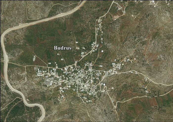
  Kart som viser Budrus.
| |||
| Wikimedia Commons: Budrus | |||
Historie
endreBudrus er arabisk for «Peter» og i oldtida vart landsbyen kalla Patris. Den moderne landsbyen ligg like aust for våpenkvilelinja frå 1949, medan oldtidsbyen truleg låg 2 km unna ved Khirbet Budrus, på vestsida av linja.[2][3] Han er nemnd i den jødiske Tosefta (Demai 1)[4] som ein del av grensa til dei sørlege fjella i Judea.[5]
I 1596 var Budrus oppført i osmanske skattelister som ein del av Ramla nahiya i Gaza liwa. Han hadde eit folketal på 46 muslimske hushaldningar og betalte skatt for kveite, bygg, oliven eller sommaravlingar, geiter eller bikubar og ei presse for oliven eller druer.[6]
Budrus vart skildra i 1870-åra som «ein liten landsby, med olivenlundar og cisterner. Han låg nær to heilage stader, og hadde ein gravplass (Imam 'Aly) i vest.»[7]
I folketeljinga i 1931 hadde Budrus 98 busette hus og eit folketal på 430 muslimar.[8] Folkesetnaden hadde auka i 510 til 1945.[9]
Nord og vest for Budrus ligg Israel si sperring på Vestbreidda og det har ofte vore demonstrasjonar mot sperringa her[10]sidan 2003.[11]
Kjelder
endre- Denne artikkelen bygger på «Budrus» frå Wikipedia på engelsk, den 22. september 2015.
- ↑ 2007 PCBS Census. Palestinsk statistisk sentralbyrå. s.114.
- ↑ Claudine Dauphin (1998). La Palestine byzantine, Peuplement et Populations, Vol. III : Catalogue. BAR International Series 726. Oxford: Archeopress. s. 831.
- ↑ Yoram Tsafrir, Leah Di Segni and Judith Green (1994). Tabula Imperii romerski: Judea, Palaestina. Jerusalem: Israel Academy of Sciences and Humanities. s. 200.
- ↑ תוספתא דמאי, פרק א
- ↑ Francis Roubiliac Conder; Claude Reignier Conder (1880). A handbook to the Bible: being a guide to the study of the Holy Scriptures: derived from ancient monuments and modern exploration. A. D. F. Randolph & company. s. 307. Henta 117. september 2015.
- ↑ Wolf-Dieter Hütteroth and Kamal Abdulfattah (1977). Historical Geography of Palestine, Transjordan and South Syria in the Late 16th Century. Erlanger Geographische Arbeiten, Sonderband 5. Erlangen, Tyskland: Vorstand der Fränkischen Geographischen Gesellschaft. s. 153.
- ↑ C. R. Conder and H. H. Kitchener (1882). The Survey of Western Palestine II. London: The Committee of the Palestine Exploration Fund. s. 296.
- ↑ E. Mills, red. (1932). Census of Palestine 1931. Population of Villages, Towns and Administrative Areas. Jerusalem: Government of Palestine. s. 19.
- ↑ Government of Palestine, Department of Statistics. Village Statistics, April, 1945. Sitert i S. Hadawi, Village Statistics, 1945. PLO Research Center, 1970|page=66}}
- ↑ Polly Pallister-Wilkins. «Radical Ground: Israeli and Palestinian Activists and Joint Protest Against the Wall». Social Movement Studies 8 (4): 393–407.
- ↑ Gideon Levy, Alex Levac,'In Budrus, no one will give us the rights – we have to struggle for them', at Haaretz, 27. juli, 2013