Fil:Africa-countries-northern.png
Høgare oppløysing er ikkje tilgjengeleg.
Africa-countries-northern.png (360 × 392 pikslar, filstorleik: 10 KB, MIME-type: image/png)
Følgjande er henta frå filomtalen åt denne fila på Wikimedia Commons:

|
Ein vektorversjon av dette biletet (SVG) er tilgjengeleg.
Han bør verta nytta i staden for dette rasterbiletet der han er betre. File:Africa-countries-northern.png → File:Africa-countries-northern.svg
For meir informasjon om vektorgrafikk, les om overgangen til SVG på commons. Det finst òg informasjon om støtta MediaWiki har for SVG-bilete. |
 |
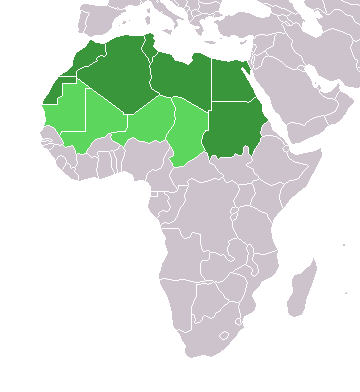
Skildring
English: Map of countries in geo-political North Africa — as considered by the U.N.
- Credits
from en:Image:Africa-countries-northern.png

|
Det er tillate å kopiera, distribuera og/eller modifisera dette dokumentet under retningslinene som er skildra i GNU fri dokumentasjonslisens, versjon 1.2 eller seinare utgåve utgjeven av Free Software Foundation; med alle seksjonane, utan nokon framsidetekstar og baksidetekstar. Ein kopi av lisensen er inkludert i avsnittet GNU Free Documentation License. |
| Denne fila er lisensiert under lisensen Creative Commons Namngjeving-DelPåSameVilkåra 3.0 Unported | ||
| ||
| Dette lisensieringsmerket vart lagt til denne fila som ein del av GFDL-lisensieringsoppdateringa. |
Filhistorikk
Klikk på dato/klokkeslett for å sjå fila slik ho var på det tidspunktet.
| Dato/klokkeslett | Miniatyrbilete | Oppløysing | Brukar | Kommentar | |
|---|---|---|---|---|---|
| gjeldande | 17. mars 2018 kl. 17:22 | | 360 × 392 (10 KB) | Maphobbyist | Montenegro border |
| 31. mars 2016 kl. 23:00 |  | 360 × 392 (10 KB) | Fry1989 | Reverted to version as of 16:12, 13 January 2014 (UTC) | |
| 7. november 2015 kl. 11:37 |  | 360 × 392 (10 KB) | Hpyounes | correction | |
| 13. januar 2014 kl. 18:12 |  | 360 × 392 (10 KB) | VVVF | See http://unstats.un.org/unsd/methods/m49/m49regin.htm | |
| 13. januar 2014 kl. 17:59 |  | 360 × 392 (13 KB) | VVVF | Reverted to version as of 20:15, 9 July 2011. See http://unstats.un.org/unsd/methods/m49/m49regin.htm | |
| 20. juli 2011 kl. 14:47 |  | 360 × 392 (7 KB) | Kahusi | See http://unstats.un.org/unsd/methods/m49/m49regin.htm | |
| 9. juli 2011 kl. 22:15 |  | 360 × 392 (13 KB) | Maphobbyist | South Sudan has become independent on July 9, 2011. Sudan and South Sudan are shown with the new international border between them. | |
| 5. mai 2006 kl. 13:13 |  | 360 × 392 (4 KB) | Hautala | optimized with png | |
| 20. april 2005 kl. 18:30 |  | 360 × 392 (14 KB) | Yonghokim | map of countries in Northern Africa. from en:Image:Africa-countries-northern.png {{GFDL}} |
Filbruk
Det finst ikkje noka side som bruker denne fila.
Global filbruk
Desse andre wikiane nyttar fila:
- Bruk på ce.wikipedia.org
- Bruk på es.wikipedia.org
- Bruk på fr.wikipedia.org
- Bruk på he.wikipedia.org
- Bruk på ru.wikipedia.org
- Bruk på sc.wikipedia.org
- Bruk på sv.wikinews.org