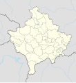
Fil:Kosovo adm location map.svg

Storleik på denne PNG-førehandsvisinga av denne SVG-fila: 548 × 599 pikslar. Andre oppløysingar: 219 × 240 pikslar | 439 × 480 pikslar | 702 × 768 pikslar | 936 × 1 024 pikslar | 1 873 × 2 048 pikslar | 1 014 × 1 109 pikslar.
Opphavleg fil (SVG-fil, standardoppløysing: 1 014 × 1 109 pikslar, filstorleik: 185 KB)

Følgjande er henta frå filomtalen åt denne fila på Wikimedia Commons:
Filhistorikk
Klikk på dato/klokkeslett for å sjå fila slik ho var på det tidspunktet.
| Dato/klokkeslett | Miniatyrbilete | Oppløysing | Brukar | Kommentar | |
|---|---|---|---|---|---|
| gjeldande | 17. mars 2020 kl. 20:29 |  | 1 014 × 1 109 (185 KB) | NordNordWest | Reverted to version as of 13:31, 16 March 2018 (UTC), not without a discussion |
| 17. mars 2020 kl. 14:15 |  | 512 × 560 (119 KB) | Zvuqniki | Reverted to version as of 13:09, 16 March 2018 (UTC) | |
| 17. mars 2020 kl. 14:12 |  | 1 014 × 1 109 (210 KB) | Zvuqniki | This map reflects the current reality regarding the border of Kosovo. Serbia has no authority over Kosovo, and there are police and military forces that all Kosovo borders. | |
| 16. mars 2018 kl. 15:31 |  | 1 014 × 1 109 (185 KB) | NordNordWest | Reverted to version as of 18:29, 12 January 2018 (UTC) Serbia still thinks that Kosovo is part of Serbia, so it stays with a dashed line | |
| 16. mars 2018 kl. 15:09 |  | 512 × 560 (119 KB) | Hakuli | Kosovo new map updatet. The dashlines are removed. The dashlines are used only when is shown a larger map. | |
| 12. januar 2018 kl. 20:29 |  | 1 014 × 1 109 (185 KB) | NordNordWest | == {{int:filedesc}} == {{Information |Description= {{de|1=Positionskarte des Kosovo}} {{en|1=Location map of Kosovo}} {{Location map series N |stretching=135 |top=43.3 |bottom=41.7 |left=19.8 |right=21.9 }} |Source={{Own using}} * United States Nationa... |
Filbruk
Meir enn 100 sider bruker denne fila. Denne lista viser dei 100 første sidene. Ei fullstendig liste som bruker denne fila er tilgjengeleg.
- Arllat
- Astrazup
- Baicë i Gllogoc
- Bajçinë
- Ballofcë
- Banjë i Malisheva
- Bardh i Madh
- Barilevë
- Batllavë
- Beguncë
- Bellacërkë
- Bellanicë
- Bllacë
- Bradash
- Brekoc
- Bresalc
- Bresje
- Brodosanë
- Carrallukë
- Damjan
- Dobrajë e Madhe
- Dobërçan
- Dumnicë e Poshtme i Podujeva
- Dushanovë
- Gadime e Epërme
- Gadime e Ulët
- Gjinoc
- Gjonaj
- Gjurakoc
- Gjylekar
- Gllamnik
- Greikoc
- Hajvalia
- Hodonoc
- Hoçë e Qytetit
- Isniq
- Janjevë
- Kabash
- Kolovicë
- Komoran
- Koretin
- Korishë
- Krushë e Madhe
- Kushnin
- Kçiq i Madh
- Letanc
- Livoç i Epërm
- Livoç i Ulët
- Llapashticë e Epërme
- Llapashticë e Poshtme
- Llapushnik
- Llashkadrenoc
- Llaushë
- Lubizhdë e Hasit
- Lubizhdë i Prizren
- Lupq i Poshtëm
- Malisheva i Gjilan
- Matiçan
- Maxhunaj
- Mazgit
- Mejë
- Mushtisht
- Nekoc
- Nëntë Jugoviq
- Obrançë
- Peqan
- Piranë
- Polac
- Pozharan
- Prekaz i Epërm
- Prugoc
- Radostë
- Ratkoc
- Raushiq
- Restelicë
- Rogaçicë
- Rogovë
- Romajë
- Samadrexhë i Suhareka
- Sferkë
- Shipol
- Skivjan
- Sllatinë e Epërme
- Smirë
- Sopië
- Stanoc i Epërm
- Strellc i Epërm
- Studençan
- Topanicë
- Tërstenik
- Vaganicë
- Vitomiricë
- Vraniq i Suhareka
- Vrellë
- Vërban
- Xërxë
- Zhabar i Poshtëm
- Zhegër
- Zhur
- Çagllavicë
Vis fleire lenkjer til denne fila.
Global filbruk
Desse andre wikiane nyttar fila:
- Bruk på af.wikipedia.org
- Bruk på als.wikipedia.org
- Bruk på an.wikipedia.org
- Bruk på ar.wikipedia.org
- Bruk på ast.wikipedia.org
- Bruk på az.wikipedia.org
- Bruk på ba.wikipedia.org
- Bruk på be-tarask.wikipedia.org
- Bruk på be.wikipedia.org
- Bruk på bg.wikipedia.org
- Bruk på bn.wikipedia.org
- Bruk på bs.wikipedia.org
Sjå meir global bruk av denne fila.


