Fil:Signal Mountain TX 1900.jpg
Storleik på førehandsvising: 800 × 564 pikslar. Andre oppløysingar: 320 × 225 pikslar | 640 × 451 pikslar | 1 024 × 721 pikslar | 1 280 × 902 pikslar | 2 000 × 1 409 pikslar.
Opphavleg fil (2 000 × 1 409 pikslar, filstorleik: 2,31 MB, MIME-type: image/jpeg)
Følgjande er henta frå filomtalen åt denne fila på Wikimedia Commons:
Skildring
| Skildring |
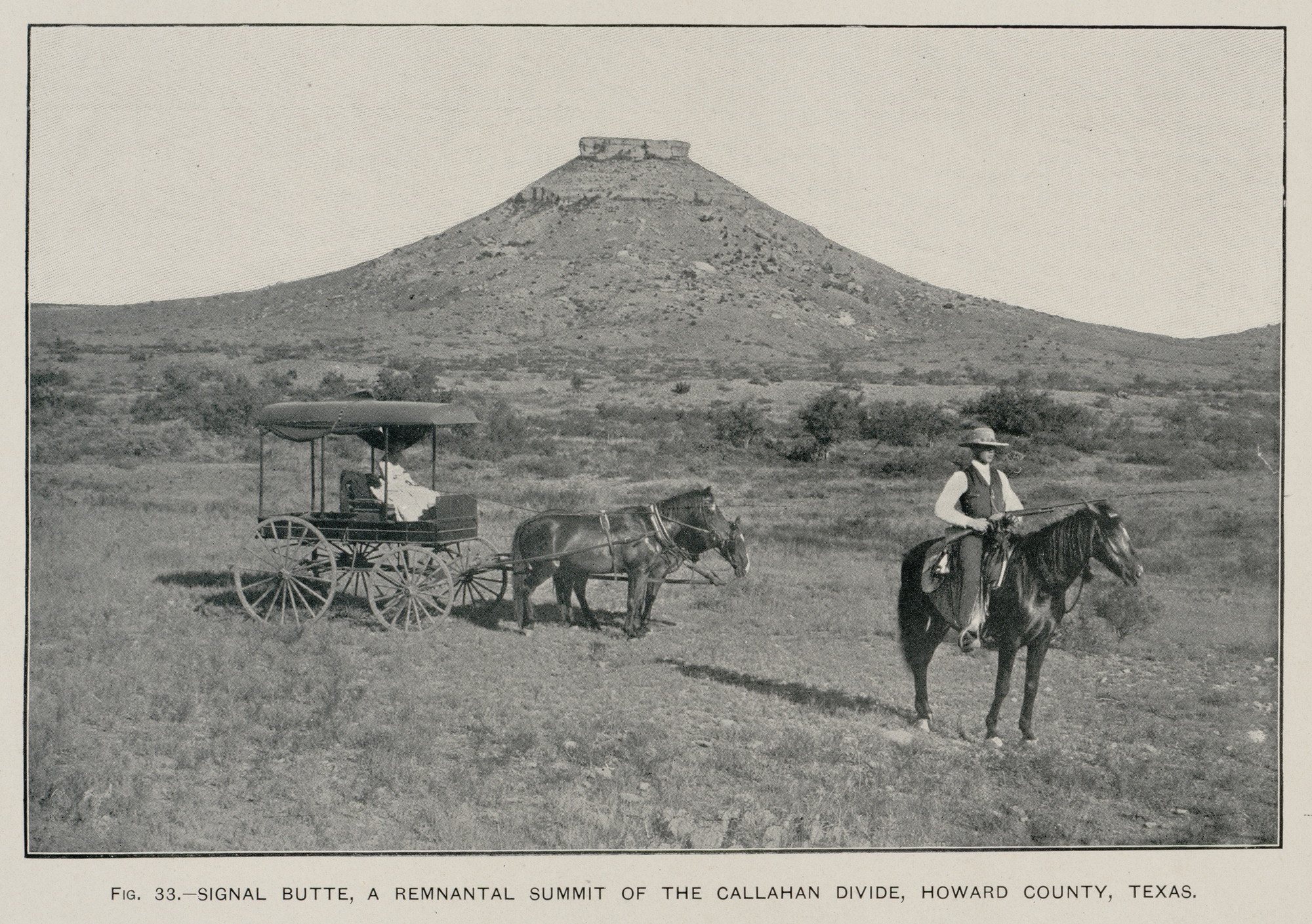
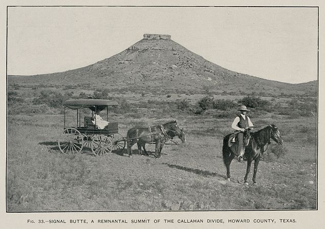
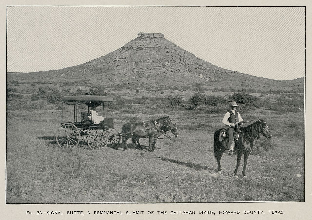
English: Signal Peak near Big Spring, Texas (Texas Geological Survey, 1889) (USGS photo, 1900) |
| Dato | |
| Kjelde | Hill, R.T. 1900. Topographic atlas of the United States: Physical geography of the Texas region. United States Department of the Interior, U.S. Geological Survey, Folio 3, 12 pp. |
| Opphavsperson | Rogers |
Lisensiering:
This image is in the public domain in the United States because it only contains materials that originally came from the United States Geological Survey, an agency of the United States Department of the Interior. For more information, see the official USGS copyright policy.
|
Filhistorikk
Klikk på dato/klokkeslett for å sjå fila slik ho var på det tidspunktet.
| Dato/klokkeslett | Miniatyrbilete | Oppløysing | Brukar | Kommentar | |
|---|---|---|---|---|---|
| gjeldande | 11. juni 2009 kl. 06:44 | | 2 000 × 1 409 (2,31 MB) | Leaflet | {{Information |Description={{en|1=Signal Peak near Big Spring, Texas (Texas Geological Survey, 1889) (USGS photo, 1900)}} |Source=Hill, R.T. 1900. Topographic atlas of the United States: Physical geography of the Texas region. United States Department of |
Filbruk
Den følgjande sida bruker denne fila:
Global filbruk
Desse andre wikiane nyttar fila:
- Bruk på ast.wikipedia.org
- Bruk på en.wikipedia.org
- Bruk på es.wikipedia.org
- Bruk på fa.wikipedia.org
- Bruk på gl.wikipedia.org
- Bruk på ja.wikipedia.org
- Bruk på nl.wikipedia.org
- Bruk på ru.wikipedia.org