Fil:South-Orkneys-Stub-Picture.png

Storleik på førehandsvising: 800 × 285 pikslar. Andre oppløysingar: 320 × 114 pikslar | 640 × 228 pikslar | 1 663 × 593 pikslar.
Opphavleg fil (1 663 × 593 pikslar, filstorleik: 13 KB, MIME-type: image/png)
Følgjande er henta frå filomtalen åt denne fila på Wikimedia Commons:
Skildring
| Skildring |
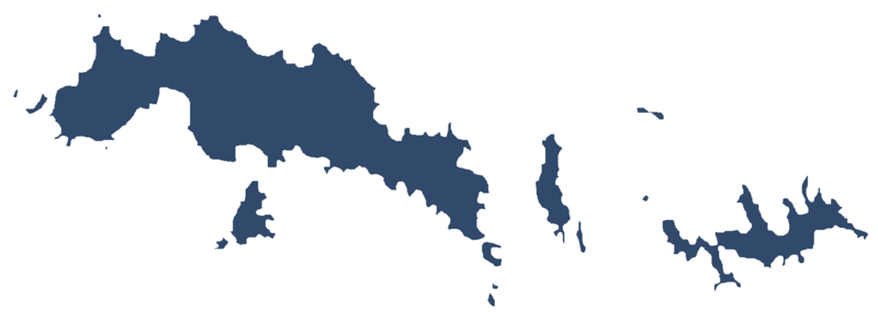
English: Image of the South Orkney Islands in Antarctica |
| Dato | |
| Kjelde | Eige arbeid |
| Opphavsperson | Apcbg |
Lisensiering:
Eg, opphavsrettshaldaren til verket, publiserer det hermed under denne lisensen:
Denne fila er lisensiert under lisensen Creative Commons Namngjeving-DelPåSameVilkåra 4.0 internasjonal.
- Du står fritt til å:
- til å dela – til å kopiera, distibuera og overføra arbeidet
- til å blanda – til å endra verket
- På desse vilkåra:
- namngjeving – Du lyt godskriva verket på den måten som opphavpersonen eller lisensgjevaren har oppgjeve (men ikkje på ein slik måte at det kan verka som om dei går god for deg eller måten du nyttar verket på).
- del på same vilkåra – Om du remiksar, omarbeider, eller på annan måte byggjer på dette verket, kan du berre distribuera resultatet under den same eller ein samsvarande lisens som denne.
Filhistorikk
Klikk på dato/klokkeslett for å sjå fila slik ho var på det tidspunktet.
| Dato/klokkeslett | Miniatyrbilete | Oppløysing | Brukar | Kommentar | |
|---|---|---|---|---|---|
| gjeldande | 17. mai 2019 kl. 19:12 | 1 663 × 593 (13 KB) | Apcbg | User created page with UploadWizard |
Filbruk
Den følgjande sida bruker denne fila:
Global filbruk
Desse andre wikiane nyttar fila:
- Bruk på ceb.wikipedia.org
- Bruk på en.wikipedia.org
- Robertson Islands
- Powell Island
- Larsen Islands
- Inaccessible Islands
- Scotia Bay
- Saddle Island, South Orkney Islands
- Shagnasty Island
- Sheila Cove
- Shingle Cove
- Mount Susini
- Iceberg Bay
- Washington Strait
- Atriceps Island
- Acuña Island
- Ailsa Craig (South Orkney Islands)
- Aitken Cove
- Laws Glacier
- Murray Islands
- Nigg Rock
- Thule Islands
- Governor Islands (South Orkney Islands)
- Wilton Bay
- Worswick Hill
- Amphibolite Point
- Cape Anderson
- Andreaea Plateau
- Baldred Rock
- Bare Rock
- Cape Barlas
- Beaufoy Ridge
- Cape Bennett
- Breccia Crags
- Bridger Bay
- Brisbane Heights
- Bruce Islands
- Buchan Bay
- Buchanan Point
- Uruguay Cove
- Usnea Ridge
- Cheal Point
- Christoffersen Island
- Cleft Point
- Cockscomb Buttress
- Coffer Island
- Coldblow Col
- Conception Point
- Confusion Island
- Conroy Point
- Oliphant Islands
Sjå meir global bruk av denne fila.