Baqa ash-Sharqiyya
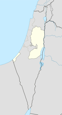
Baqa ash-Sharqiyya (arabisk باقه الشرقية) er ein palestinsk by nord på Vestbreidda, 16 km nordaust for Tulkarm i Tulkarm guvernement. I følgje Palestinsk statistisk sentralbyrå (PCBS), hadde byen eit folketal på 4 101 innbyggjarar i 2007.[2] Flyktningar utgjorde 20,4 % av folkesetnaden i Baqa ash-Sharqiyya i 1997.[3]
| Baqa ash-Sharqiyya | |||
| باقه الشرقية, Baqa al-Sharqiyya, Baqa ash-Sharkiya | |||
| kommune | |||
| Namneopphav: Den austlege blomsterbuketten[1] | |||
| Land | |||
|---|---|---|---|
| Guvernement | Tulkarm guvernement | ||
| Koordinatar | 32°24′38.10″N 35°04′08.91″E / 32.4105833°N 35.0691417°E | ||
| Areal | 4,2 km² | ||
| Folketal | 4 101 (2007) | ||
| Folketettleik | 976 / km² | ||
| Borgarmeister | Muaiad Abd al-Rahman Hussein | ||
 Baqa ash-Sharqiyya 32°24′38″N 35°04′09″E / 32.410583333333°N 35.069141666667°E | |||
| Wikimedia Commons: Baqa ash-Sharqiyya | |||
Kring 3 km mot vest, på den andre sida av Den grøne linja, ligg Baqa al-Gharbiyye, («den vestlege blomsterbuketten») som høyrer til Israel. Begge byane var opphavleg ein enkel by, kalla Baqa, fram til etterverknaden etter den arabisk-israelske krigen i 1948. Før den andre Intifada bestod Baqa ash-Sharqiyya av 4 000 mål, men Israel konfiskerte kring 2 000 mål land for å byggje sperremuren/gjerdet på Vestbreidda.[4]
Historie
endreBaqa ash-Sharqiyya ligg på ein gammal stad. Tidleg under osmansk styre, i 1596, låg Baqa ash-Sharqiyya i Qaqun nahiya i Nablus sanjak. Han hadde eit folketal på 35 hushaldningar, og betalte skatt for kveite, bygg, sommaravlingar, oliven, geiter og/eller bier, og ei presse for oliven eller druer.[5][6]
I 1882 skildra Palestine Exploration Fund i Survey of Western Palestine Baqa som «ei lita grend på ei høgd, med oliven. Han har ein brunn i sør og ein liten Mukam (muslimsk grav) i nord; spreidd oliven kring seg, og det er to eller tre palmer i nælriken. Husa står spreidd.»[7]
I folketeljinga i 1922 hadde Baqa Sharkiyeh eit folketal på 269, alle muslimar,[8] dette auka i folketeljinga i 1931 til 330, framleis alle muslimar, i 67 hus.[9]
I 1945 bestod folkesetnaden i Baqa ash-Sharqiyya av 480 arabarar på eit landområde på 3 986 mål, i følgje ei offisiell landmåling.[10] Av dette var 173 dekar for plantasjar og irrigert land, 2 870 for cereals,[11] medan 14 dekar var utbygde område.[12]
Som ein del av våpenkvileavtalen i 1949 etter den israelsk-arabiske krigen i 1948, avstod kong Abdullah av Jordan det erobra Wadi Ara-området til Israel i byte mot land nær Hebron. Dette førte til at Baqa al-Gharbiyye falt på vestsida av Den grøne linja, og vart skild frå den austlege delen, Baqa ash Sharqiyya. Den separerte byen har framleis tette sosiale og økonomiske band, men dette har blitt redusert etter muren på Vestbreidda stod ferdig.[13]
Kjelder
endre- ↑ Palmer, 1881, s. 179
- ↑ 2007 PCBS census. Palestinsk statistisk sentralbyrå (PCBS). s. 107.
- ↑ palestinsk Population by Locality and Refugee Status Arkivert 2012-02-07 ved Wayback Machine. Palestinsk statistisk sentralbyrå
- ↑ Baqa Al Sharqia: A Palestine Villeage isolated by the Segregation Wall Arkivert 2009-07-14 ved Wayback Machine. Land Research Sentral. 13. august 2003.
- ↑ al-Salim, Farid. Landed Property and Elite Conflict in Ottoman Tulkarm. Jerusalem Quarterly. Autumn 2011.
- ↑ Hütteroth and Abdulfattah, 1977, s. 159
- ↑ Conder and Kitchner, SWP, 1882, s. 152
- ↑ J. B. Barron, red. (1923). Palestine: Report and General Abstracts of the Census of 1922. Government of Palestine. Table IX, Underdistrikt of Tulkarem, s. 27.
- ↑ Mills, 1932, s. 53
- ↑ Government of Palestine, Department of Statistics. Village Statistics, April, 1945. Sitert i S. Hadawi, Village Statistics, 1945. PLO Research Sentral, 1970, s. 74
- ↑ Government of Palestine, Department of Statistics. Village Statistics, April, 1945. Sitert i S. Hadawi, Village Statistics, 1945. PLO Research Sentral, 1970, s. 124
- ↑ Government of Palestine, Department of Statistics. Village Statistics, April, 1945. Sitert i S. Hadawi, Village Statistics, 1945. PLO Research Sentral, 1970, s. 174
- ↑ Profile: Baqa Sharqiya Enclave & Qafin UNRWA
- Denne artikkelen bygger på «Baqa ash-Sharqiyya» frå Wikipedia på engelsk, den 19. september 2015.
- Wikipedia på engelsk oppgav desse kjeldene:
- Conder, Claude Reignier; Kitchener, H. H. (1882). The Survey of Western Palestine: Memoirs of the Topography, Orography, Hydrography, and Archeology 2. London: Committee of the Palestine Exploration Fund.
- Hadawi, Sami (1970), Village Statistics of 1945: A Classification of Land and Area ownership in Palestine, Palestinsk frigjeringsorganisasjon forskingssentral
- Hütteroth, Wolf-Dieter; Abdulfattah, Kamal (1977). Historical Geography of Palestine, Transjordan and South Syria in the Late 16th Century. Erlanger Geographische Arbeiten, Sonderband 5. Erlangen, Tyskland: Vorstand der Fränkischen Geographischen Gesellschaft.
- Mills, E., red. (1932). Census of Palestine 1931. Population of Villages, Towns and Administrative Areas (PDF). Jerusalem: Government of Palestine.
- Palmer, E. H. (1881). The Survey of Western Palestine: Arabic and English Name Lists Collected During the Survey by Lieutenants Conder og Kitchener, R. E. Transliterated and Explained by E.H. Palmer. Committee of the Palestine Exploration Fund.
- Sharon, Moshe (1999), Corpus Inscriptionum Arabarum Palaestinae, Vol. II, B-C, BRILL, ISBN 90-04-11083-6

