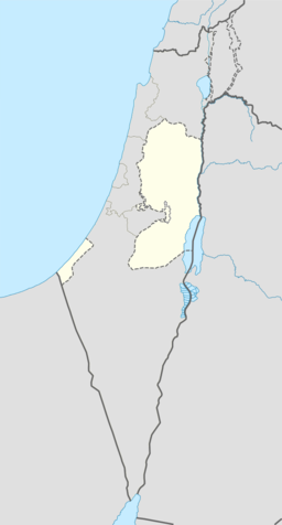
Beit Liqya
Beit Liqya (arabisk بيت لقيا) er ein palestinsk by som ligg i Ramallah og al-Bireh guvernement nord på Vestbreidda, 21 kilometer sørvest for Ramallah. I følgje Palestinsk statistisk sentralbyrå hadde han eit folketal på kring 7 710 i 2007.[2]
| Beit Liqya | |||
| بيت لقيا, Bayt Liqya | |||
| kommune | |||
| Namneopphav: Likiahuset[1] | |||
| Land | |||
|---|---|---|---|
| Guvernement | Ramallah og al-Bireh guvernement | ||
| Koordinatar | 31°52′09″N 35°04′01″E / 31.86917°N 35.06694°E | ||
| Folketal | 11 500 (2011) | ||
| Borgarmeister | Khaled Badr | ||
 Beit Liqya 31°52′09″N 35°04′01″E / 31.869166666667°N 35.066944444444°E | |||
| Wikimedia Commons: Beit Liqya | |||
Historie
endreBeit Liqya, vart som resten av Palestina, ein del av Det osmanske riket in1517, og i 1557 vart inntekter frå landsbyen gjeven til ein ny waqf i Hasseki Sultan Imaret i Jerusalem, oppretta av hasseki Hurrem Sultan (Roxelana), kona til Suleiman den store.[3]
Den franske oppdagaren Victor Guérin vitja landsbyen i 1863, og estimerte at han hadde kring 500 innbyggjarar. Han nemnte òg ein wali for ein sjeik Abou Ismail.[4] I 1883 skildra Palestine Exploration Fund i Survey of Western Palestine Beit Likia som ein «liten landsby langs hovudvegen ved foten av åsane, forsynt av cisterner. Det ligg eldgamle tufter mellom husa.»[5]
I ei folketeljing i 1922 utført av Dei britiske mandatstyresmaktene hadde hadde Beit Leqia eit folketal på 739, alle muslimar,[6] dette auka i folketeljinga i 1931, då Beit Liqya hadde 209 busette hus og eit folketal på 858, framleis alle muslimar.[7]
I 1945 var folketalet 1 040, alle arabarar, medan det samla landarealet var 14 358 mål, i følgje ei offisiell landmåling.[8] Av dette var 1 918 for plantasjar og irrigert land, 6 469 for korn,[9] medan 39 mål var klassifisert som utbygde område.[10]
Kjelder
endre- Denne artikkelen bygger på «Beit Liqya» frå Wikipedia på engelsk, den 22. september 2015.
- Wikipedia på engelsk oppgav desse kjeldene:
- Barron, J. B., red. (1923). Palestine: Report and General Abstracts of the Census of 1922. Government of Palestine.
- Conder, Claude Reignier; Kitchener, Herbert H. (1883). The Survey of Western Palestine: Memoirs of the Topography, Orography, Hydrography, and Archeology 3. London: Committee of the Palestine Exploration Fund.
- Guérin, Victor (1868). Description Géographique Historique et Archéologique de la Palestine (på fransk). 1: Judee, pt. 1. Paris: L'Imprimerie Nationale.
- Hadawi, Sami (1970), Village Statistics of 1945: A Classification of Land and Area ownership in Palestine, Palestinsk frigjeringsorganisasjon forskingssentral
- Mills, E., red. (1932). Census of Palestine 1931. Population of Villages, Towns and Administrative Areas (PDF). Jerusalem: Government of Palestine.
- Palmer, E. H. (1881). The Survey of Western Palestine: Arabic and English Name Lists Collected During the Survey by Lieutenants Conder og Kitchener, R. E. Transliterated and Explained by E.H. Palmer. Committee of the Palestine Exploration Fund.
- Singer, A. (2002). Constructing Ottoman Beneficence: An Imperial Soup Kitchen in Jerusalem. Albany: State University of New York Press. ISBN 0-7914-5352-9.
- Socin, A. (1879). «Alphabetisches Verzeichniss von Ortschaften des Paschalik Jerusalem». Zeitschrift des Deutschen Palästina-Vereins 2: 135–163.
- ↑ Palmer, 1881, s. 286
- ↑ 2007 PCBS Census. Palestinsk statistisk sentralbyrå. s.115.
- ↑ Singer, 2002, s. 50, citing TSAE-7816/8. (TSAE=Topkapi Saray Arsivi, Evrak).
- ↑ Guérin, 1868, s. 347
- ↑ Conder og Kitchener, 1883, SWP III, s. 16
- ↑ Barron, 1923, Table VII, Ramallah underdistrikt, s. 16
- ↑ Mills, 1932, s. 62.
- ↑ Government of Palestine, Department of Statistics. Village Statistics, April, 1945. Sitert i S. Hadawi, Village Statistics, 1945. PLO Research Sentral, 1970, s. 64
- ↑ Government of Palestine, Department of Statistics. Village Statistics, April, 1945. Sitert i S. Hadawi, Village Statistics, 1945. PLO Research Sentral, 1970, s. 111
- ↑ Government of Palestine, Department of Statistics. Village Statistics, April, 1945. Sitert i S. Hadawi, Village Statistics, 1945. PLO Research Sentral, 1970, s. 161


