Fil:Location map Taifa of Badajoz.svg

Storleik på denne PNG-førehandsvisinga av denne SVG-fila: 711 × 599 pikslar. Andre oppløysingar: 285 × 240 pikslar | 570 × 480 pikslar | 911 × 768 pikslar | 1 215 × 1 024 pikslar | 2 430 × 2 048 pikslar | 713 × 601 pikslar.
Opphavleg fil (SVG-fil, standardoppløysing: 713 × 601 pikslar, filstorleik: 273 KB)
Følgjande er henta frå filomtalen åt denne fila på Wikimedia Commons:
| Skildring |
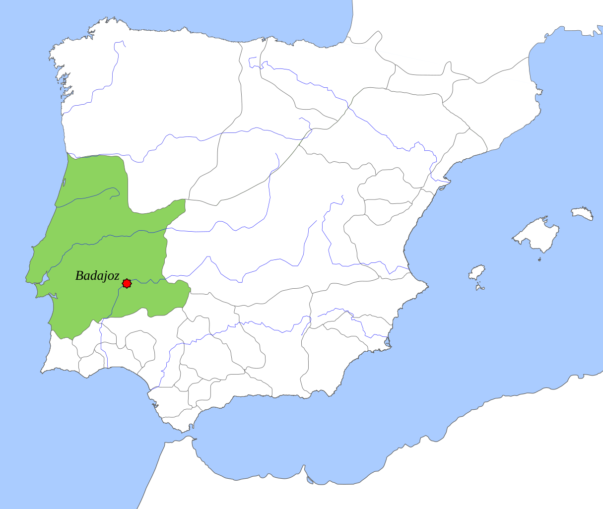
English: Taifa Kingdom of Badajoz (1037), location map. |
||||||||
| Dato | |||||||||
| Kjelde | Eige arbeid | ||||||||
| Opphavsperson | Tyk | ||||||||
| Løyve (Gjenbruk av denne fila) |
|

Filhistorikk
Klikk på dato/klokkeslett for å sjå fila slik ho var på det tidspunktet.
| Dato/klokkeslett | Miniatyrbilete | Oppløysing | Brukar | Kommentar | |
|---|---|---|---|---|---|
| gjeldande | 6. oktober 2018 kl. 16:31 | | 713 × 601 (273 KB) | Tyk | Removing frame. Improving contrast of land and sea. Softening borders. Enlarging context. |
| 8. desember 2008 kl. 13:24 |  | 694 × 540 (346 KB) | Tyk | {{Information |Description={{en|1=Taifa Kingdom of Badajoz (1037), location map.}} |Source=Own work by uploader |Author=Té y kriptonita |Date=Dec 2008 |Permission={{GFDL}} |other_versions= }} <!--{{ImageUpload|full}}--> [[Categ |
Filbruk
Den følgjande sida bruker denne fila:
Global filbruk
Desse andre wikiane nyttar fila:
- Bruk på ar.wikipedia.org
- Bruk på bn.wikipedia.org
- Bruk på br.wikipedia.org
- Bruk på ca.wikipedia.org
- Bruk på de.wikipedia.org
- Bruk på en.wikipedia.org
- Bruk på es.wikipedia.org
- Bruk på eu.wikipedia.org
- Bruk på ext.wikipedia.org
- Bruk på fr.wikipedia.org
- Bruk på gl.wikipedia.org
- Bruk på hu.wikipedia.org
- Bruk på it.wikipedia.org
- Bruk på ja.wikipedia.org
- Bruk på ko.wikipedia.org
- Bruk på nl.wikipedia.org
- Bruk på pt.wikipedia.org
- Bruk på ru.wikipedia.org
- Bruk på uk.wikipedia.org