Alicebreen
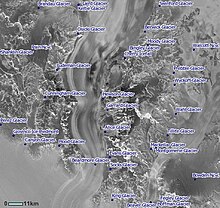
Alicebreen er ein 24 km lang sidebre i Aust-Antarktis. Han flyt aust frå Queen Alexandra Range og ut i Beardmorebreen ved Sirohi Point. Han vart oppdaga av Nimrod-ekspedisjonen, 1907–09, under Ernest Shackleton og vart kalla opp etter mora til Eric Marshall, som følgde Shalcketon i forsøket på å nå Sørpolen.[1]
| Alicebreen | |||
| isbre | |||
| Land | |||
|---|---|---|---|
| Stad | Ross Dependency | ||
| - koordinatar | 83°58′S 170°0′E / 83.967°S 170.000°E | ||
| Lengd | 24 km | ||
| Administrert under | Antarktistraktaten | ||
 Alicebreen 83°58′00″S 170°00′00″E / 83.9667°S 170°E | |||
Kjelder
endre- ↑ «Alice Glacier». Geographic Names Information System. United States Geological Survey, United States Department of the Interior. Henta 2. mars 2013.
Denne artikkelen inneheld stoff som er offentleg eige frå United States Geological Survey-artikkelen «Alicebreen» (innhald frå Geographic Names Information System).

