Beit Iksa
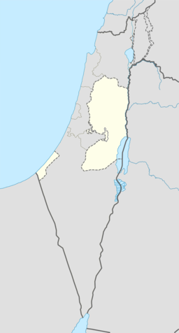
Beit Iksa (arabisk بيت إكسا, hebraisk skrift בית איכסא) er ein palestinsk landsby i Jerusalem guvernement, 6 kilometer nordvest for Jerusalem på Vestbreidda. Beit Iksa har 1 600 innbyggjarar og ligg i «Område B», som tyder at dei sivile sakene blir administrert av Den palestinske sjølvstyresmakta, medan Det israelske forsvaret tar seg av tryggleiken.[2]
| Beit Iksa | |||
| بيت إكسا, Beit Exa, Bayt Iksa | |||
| kommune | |||
Beit Iksa, 2011
| |||
| Namneopphav: Iksa-huset[1] | |||
| Land | |||
|---|---|---|---|
| Guvernement | Jerusalem guvernement | ||
| Koordinatar | 31°49′05″N 35°10′50″E / 31.81806°N 35.18056°E | ||
| Areal | 7,7 km² | ||
| Folketal | 1 600 (2006) | ||
| Folketettleik | 208 / km² | ||
| Borgarmeister | Bajes Abud | ||
 Beit Iksa 31°49′05″N 35°10′50″E / 31.81805556°N 35.18055556°E | |||
| Wikimedia Commons: Beit Iksa | |||
| Nettstad: www.beitexa.com | |||
Historie
endreI krossfarartida vart landsbyen kalla Jenanara.[3]
Landsbyen vart ein del av Det osmanske riket i 1517 i lag med resten av Palestina og i 1596 stod han oppført som Bayt Kisa i skattelister som ein del av Quds nahiya i Quds liwa. Han hadde eit folketal på 79 hushaldningar, alle muslimar, og betalte skatt for kveite, bygg, oliventre, vindruer, frukttre, hagar, geiter eller bikubar, og ei presse for oliven eller druer.[4]
I 1841 bygde ein lokal leiar, Abd al-Qadir al-Khatib, ei osmansk borg sør i landsbyen, medan ein av brørne hans bygde ein mindre versjon fem år seinare.[5]
I 1863 vitja den franske oppdagaren Victor Guérin landsbyen og estimerte at han hadde 300 innbyggjarar. Han skreiv at området rundt var oppdyrka med vindruer og oliventre.[6] I 1883 skildra Palestine Exploration Fund i Survey of Western Palestine at «landsbyen var mellomstor, med steinhus, og ein brunn i nord, nær det heilage treet Neby Leimun. Det står nokre få oliven kring landsbyen.»[7]
I 1945 hadde Bein Iksa eit folketal på 1 410, alle arabarar, med 8 179 mål land, i følgje ei offisiell landmåling.[8] Av dette var 1 427 mål var plantasjar og irrigert land, 2 690 nytta for korn,[9] medan 43 mål vart utbygd land.[10]
I april 1948 flykta dei fleste landsbybuarane etter Deir Yassin fall og Haganah-styrkar gjekk inn i landsbyen og øydela mange bygningar.[11]
Demografi
endreI følgje Palestinsk statistisk sentralbyrå (PCBS) hadde Beit Iksa eit folketal på kring 1 600 innbyggjarar i 2006.[12] Av dette er over 80 % palestinske flyktningar.[2]
I ei folketeljing i 1922 utført av Det britiske mandatet styresmaktene, hadde «Bait Iksa» eit folketal på 791, alle muslimar,[13] og dette auka i folketeljinga i 1931 til eit folketal på 1003, framleis alle muslimar, i 221 hus.[14]
Folketalet voks til 1 410 i 1945.
Kjelder
endre- Denne artikkelen bygger på «Beit Iksa» frå Wikipedia på engelsk, den 29. september 2015.
- Wikipedia på engelsk oppgav desse kjeldene:
- Barron, J. B., red. (1923). Palestine: Report and General Abstracts of the Census of 1922. Government of Palestine.
- Clermont-Ganneau, Charles Simon (1899). [ARP] Archaeological Researches in Palestina 1873-1874, omsett frå fransk av J. McFarlane 1. London: Palestine Exploration Fund.
- Clermont-Ganneau, Charles Simon (1896). [ARP] Archaeological Researches in Palestina 1873-1874, omsett frå fransk av J. McFarlane 2. London: Palestine Exploration Fund.
- Conder, Claude Reignier; Kitchener, H. H. (1883). The Survey of Western Palestine: Memoirs of the Topography, Orography, Hydrography, and Archeology 3. London: Committee of the Palestine Exploration Fund.
- Guérin, Victor (1868). Description Géographique Historique et Archéologique de la Palestine (på fransk). 1: Judee, pt. 1. Paris: L'Imprimerie Nationale.
- Guérin, Victor (1875). Description Géographique Historique et Archéologique de la Palestine. Vol 2; Samarie, pt. 2. s. 400
- Hadawi, Sami (1970). Village Statistics of 1945: A Classification of Land and Area ownership in Palestine. Palestinsk frigjeringsorganisasjon forskingssentral.
- Hütteroth, Wolf-Dieter; Abdulfattah, Kamal (1977). Historical Geography of Palestine, Transjordan and South Syria in the Late 16th Century. Erlanger Geographische Arbeiten, Sonderband 5. Erlangen, Tyskland: Vorstand der Fränkischen Geographischen Gesellschaft. ISBN 3-920405-41-2.
- Mills, E., red. (1932). Census of Palestine 1931. Population of Villages, Towns and Administrative Areas (PDF). Jerusalem: Government of Palestine.
- Palmer, E. H. (1881). The Survey of Western Palestine: Arabic and English Name Lists Collected During the Survey by Lieutenants Conder og Kitchener, R. E. Transliterated and Explained by E.H. Palmer. Committee of the Palestine Exploration Fund.
- Robinson, Edward; Smith, Eli (1841). Biblical Researches in Palestine, Mount Sinai and Arabia Petraea: A Journal of Travels in the year 1838 2. Boston: Crocker & Brewster. (p. 141)
- Sharon, Moshe (1999). Corpus Inscriptionum Arabarum Palaestinae, B-C 2. BRILL. ISBN 9004110836.
- Socin, A. (1879). «Alphabetisches Verzeichniss von Ortschaften des Paschalik Jerusalem». Zeitschrift des Deutschen Palästina-Vereins 2: 135–163.
- ↑ Palmer, 1881, s. 286
- ↑ 2,0 2,1 Village Profiles: Profile of Beit Iksa, Jerusalem SNs hjelpeorganisasjon. January 2004.
- ↑ Clermont-Ganneau, 1899, vol. 1, s. 479
- ↑ Hütteroth and Abdulfattah, 1977, s. 121.
- ↑ Sharon, 1999, s. 105 ff.
- ↑ Guérin, 1868, s. 256
- ↑ Conder og Kitchener, 1883, s. 8
- ↑ Government of Palestine, Department of Statistics. Village Statistics, April, 1945. Sitert i S. Hadawi, Village Statistics, 1945. PLO Research Sentral, 1970, s. 56
- ↑ Government of Palestine, Department of Statistics. Village Statistics, April, 1945. Sitert i S. Hadawi, Village Statistics, 1945. PLO Research Sentral, 1970, s. 101
- ↑ Government of Palestine, Department of Statistics. Village Statistics, April, 1945. Sitert i S. Hadawi, Village Statistics, 1945. PLO Research Sentral, 1970, s. 151
- ↑ Morris, Benny (1987) The birth of the Palestinian refugee problem, 1947-1949. Cambridge University Press. ISBN 0-521-33028-9. s.114 158
- ↑ Projected Mid -Year Population for Jerusalem guvernement by Locality 2004- 2006 Arkivert 2012-02-07 ved Wayback Machine. Palestinsk statistisk sentralbyrå (PCBS)
- ↑ Barron, 1923, Table VII, Subdistrict of Jerusalem, s. 14
- ↑ Mills, 1932, s. 38


