Kharbatha al-Misbah
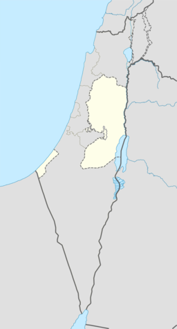
Kharbatha al-Misbah (arabisk خربثا المصباح) er ein palestinsk by sentralt på Vestbreidda, 15 km vest for Ramallah i Ramallah og al-Bireh guvernement. I følgje Palestinsk statistisk sentralbyrå hadde byen eit folketal på 5 211 i 2007.[3] I nærleiken ligg Beit Liqya i sør og Beit Ur at-Tahta i aust. Han vart styrt som ein landsbykommune.[4]
| Kharbatha al-Misbah | |||
| خربثا المصباح, Kharbatha al-Misbah, Khirbet al-Misbah, Khurbetha ibn es Seba | |||
| kommune | |||
| Namneopphav: Ruinane av sonen av villdyret, eller «dei sju»[1] | |||
| Land | |||
|---|---|---|---|
| Guvernement | Ramallah og al-Bireh guvernement | ||
| Koordinatar | 31°53′30″N 35°04′18″E / 31.89167°N 35.07167°E | ||
| Areal | 4,4 km² | ||
| Folketal | 5 211 (2007) | ||
| Folketettleik | 1 184 / km² | ||
| Borgarmeister | Sa'di Jabir Ibrahim Daraj[2] | ||
 Kharbatha al-Misbah 31°53′30″N 35°04′18″E / 31.891666666667°N 35.071666666667°E | |||
| Wikimedia Commons: Kharbatha al-Misbah | |||
Historie
endreI 1883 skildra «Survey of Western Palestina» landsbyen, som då vart kalla Khurbetha ibn es Seba, som «ein liten landsby på ein rygg, med ein brunn i aust.»[5]
I folketeljinga i 1922, utført av Dei britiske mandatstyresmaktene hadde Kherbet al-Mesbah eit folketal på 369, alle muslimar.[6] I folketeljinga i 1931 hadde dette auka til 488, framleis alle muslimar, i 121 busette hus.[7]
I 1945 var folketalet i Khirbat el Misbah 600, alle arabarar, som eigde 4 438 mål land i følgje ei offisiell landmåling.[8] 1 026 mål var plantasjar og irrigert land, 2 133 nytta for korn,[9] medan 25 mål var utbygd (urbant) land.[10]
Det ligg to moskéar i byen: Omri-moskeen og al-Kawthar-moskeen. Den førstenemnde vart bygd over ruinane av ei eldgammal kyrkje og renovert i 1965. Innafor kommunegrensa ligg eldgamle romerske graver og jødiske synagoger.
Kjelder
endre- ↑ Palmer, 1881, s. 313
- ↑ Vestbreidda Arkivert 2007-06-30 ved Wayback Machine. Local Elections ( Round two)- Successful candidates by local authority, gender and No. of votes obtained, Kharbatha Misbah p 22
- ↑ 2007 PCBS Census. Palestinsk statistisk sentralbyrå. s.113.
- ↑ Historie of the Village Palestina Remembered.
- ↑ Conder og Kitchener, 1882, III, s. 15
- ↑ J. B. Barron, red. (1923). Palestine: Report and General Abstracts of the Census of 1922. Government of Palestine. Table VII, Ramallah underdistrikt.
- ↑ E. Mills, red. (1932). Census of Palestine 1931. Population of Villages, Towns and Administrative Areas (PDF). Jerusalem: Government of Palestine. s. 50.
- ↑ Government of Palestine, Department of Statistics. Village Statistics, April, 1945. Sitert i S. Hadawi, Village Statistics, 1945. PLO Research Sentral, 1970, s. 65
- ↑ Government of Palestine, Department of Statistics. Village Statistics, April, 1945. Sitert i S. Hadawi, Village Statistics, 1945. PLO Research Sentral, 1970, s. 112
- ↑ Government of Palestine, Department of Statistics. Village Statistics, April, 1945. Sitert i S. Hadawi, Village Statistics, 1945. PLO Research Sentral, 1970, s. 162
- Denne artikkelen bygger på «Kharbatha al-Misbah» frå Wikipedia på engelsk, den 22. september 2015.
- Wikipedia på engelsk oppgav desse kjeldene:
- Conder, Claude Reignier; Kitchener, H. H. (1883). The Survey of Western Palestine: Memoirs of the Topography, Orography, Hydrography, and Archeology 3. London: Committee of the Palestine Exploration Fund.
- Hadawi, Sami (1970), Village Statistics of 1945: A Classification of Land and Area ownership in Palestine, Palestinsk frigjeringsorganisasjon forskingssentral
- E. Mills, red. (1932). Census of Palestine 1931. Population of Villages, Towns and Administrative Areas (PDF). Jerusalem: Government of Palestine.
- Palmer, E. H. (1881). The Survey of Western Palestine: Arabic and English Name Lists Collected During the Survey by Lieutenants Conder og Kitchener, R. E. Transliterated and Explained by E.H. Palmer. Committee of the Palestine Exploration Fund.


